

具体描述
| 基本信息 | |||||||||||||||||||
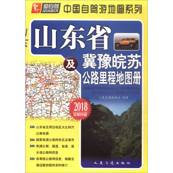
| 书名: | 增城指南地图 | ||||||||||||||||||
| 出版社: | 广东省地图出版社 | ||||||||||||||||||
| 书号: | ISBN 9787807211488 | ||||||||||||||||||
| 审图号: | 粤S(2015)021号 | ||||||||||||||||||
| 版印次: | 2018年 | ||||||||||||||||||
| 语种: | 中文 | ||||||||||||||||||
| 装帧: | 袋装 | ||||||||||||||||||
| 净重: | 0.006kg | ||||||||||||||||||
| 定价: | 8元 | ||||||||||||||||||
用户评价
我最近刚入手了这本《2018增城指南地图》,简直是太惊喜了!我本以为它只是一张普通的地图,但翻开后才发现它的信息量超乎我的想象。首先,它不仅仅是增城区中心城区的地图,还巧妙地将周边的深圳、东莞、惠州、中山、香港、珠海等地都囊括了进来,而且是用一种非常直观的方式呈现。这对于我这种经常需要在这些城市之间来回奔波的人来说,简直是神器!地图上的交通网络信息特别全,包括了主要的道路、高速公路、甚至是部分省道和县道。我最看重的是它对于区域之间连接的清晰展示,比如从增城去往深圳或者惠州,地图上能清晰地看到有多条路线可供选择,而且还标注了大致的行程时间和一些关键的连接点。更让我惊喜的是,地图上还标注了一些重要的交通枢纽,比如火车站、汽车站,甚至是一些轮渡码头,这让我的出行规划变得前所未有的便捷。它就像一个超级导航仪,把整个珠江三角洲的交通脉络都呈现在我眼前,让我能够轻松规划跨区域的行程。The visual representation of connectivity between these major cities is outstanding, allowing for quick comparisons of travel times and potential routes. It's evident that a lot of effort went into compiling this extensive geographical and logistical data, making it an invaluable resource for anyone navigating the dynamic landscape of Southern China. The layered information, from major arteries to finer provincial roads, provides a robust understanding of the transportation infrastructure.
评分我是一名学生,最近在做关于珠江三角洲城市发展的研究,偶然发现了这本《2018增城指南地图》,真的让我眼前一亮。首先,地图的范围非常广,不仅仅局限于增城区,而是将深圳、东莞、惠州、中山、香港、珠海这些重要的经济中心都囊括在内,这为我的研究提供了非常宝贵的宏观视角。地图上对于交通网络的描绘尤其详细,包括了公路、铁路、甚至一些重要的水路交通线,这对于分析城市间的经济联系和物流走向非常有帮助。我发现地图上还标注了一些工业园区、商业中心和高新技术产业开发区,这些信息对于我理解不同城市的产业布局和发展模式非常有启发。它不仅仅是一张地理地图,更像是一张包含了经济和社会发展信息的“城市发展概览图”。我能够通过这张地图,直观地看到增城与这些主要经济体之间的地理距离和交通联系,从而分析其在区域经济发展中的地位和潜力。The integration of geographical data with socio-economic indicators, as implicitly presented through the mapping of industrial zones and commercial hubs, makes this an exceptional resource for academic research. The expansive geographical scope, encompassing major economic powerhouses in the Pearl River Delta, offers a rich tapestry of information for analyzing inter-city dynamics and regional development trends. Its utility extends far beyond simple navigation, providing a foundation for detailed logistical and economic studies.
评分作为一名常年在广东省内活动的商务人士,我对于地图的要求非常高,尤其需要能清晰展示城市之间以及城市内部的交通连接。这本《2018增城指南地图》正好满足了我的需求。地图上关于增城中心城区的绘制非常精细,大小道路、重要建筑、商业区、工业区都有明确的标注。更重要的是,它把周边几个重要城市,如深圳、东莞、惠州、中山、香港、珠海的交通图都串联起来了,这使得我在规划跨区域的商务行程时,能够非常直观地比较不同城市之间的交通便利性,以及选择最佳的出行路线。我尤其看重地图上对高速公路、国道以及一些主要干道的清晰标示,这对于我快速判断行程时间和选择最优路线至关重要。而且,地图的整体布局合理,信息层级分明,不会让人感到眼花缭乱。它提供了一种全局性的视角,让我能够迅速了解增城在整个珠三角经济圈中的地理位置和交通枢纽地位。The comprehensive coverage of multiple key cities within the Guangdong province, presented in a unified and coherent manner, is a standout feature. This allows for a holistic understanding of regional connectivity and facilitates efficient long-distance travel planning for business purposes. The emphasis on major transportation arteries and their interconnections is particularly valuable for navigating the complex logistics of inter-city travel in this economically vibrant region.
评分对于经常需要出差或者旅游的地理爱好者来说,这本《2018增城指南地图》绝对是值得入手的一件利器。我平时就喜欢研究地图,而这本地图的编绘水平相当高。它不仅仅是一张图,更像是一部关于增城及周边地区的立体百科。地图的精度非常高,我仔细比对了一些我熟悉的区域,连一些公园内的步道、社区内的主要出入口都标注了出来,可见其细致程度。而且,它将增城区中心城区图与周边城市(深圳、东莞、惠州、中山、香港、珠海)的交通旅游挂图巧妙地融合在一起,这是一种非常聪明的呈现方式。我能清晰地看到增城在整个大湾区中的位置,以及它与周边城市的陆路、水路联系。地图上还对一些重要的旅游景点进行了标注,并且用不同的符号区分,这对于我这种喜欢探索新地方的人来说,简直是如获至宝。它不是那种简单的旅游指南,而是更侧重于地理信息和交通网络的构建,让使用者能够更深入地理解区域的整体格局。The cartography employed is of a high standard, providing a wealth of geographical detail that goes beyond mere street names. Its ability to seamlessly integrate the detailed local map with the broader regional context is a testament to its excellent design. I appreciate the effort taken to include not just major thoroughfares but also the more nuanced road networks that are crucial for in-depth exploration. This map offers a perspective that is both macro and micro, catering to a wide range of investigative interests.
评分这本《2018增城指南地图》简直是给我这次广州之行解了燃眉之急!我计划去增城玩几天,但之前对那里的路况和景点完全没概念。这本地图一到手,我就迫不及待地翻开。首先,地图的清晰度真的没话说,每一个街道、每一个小巷都标示得一清二楚, Even some of the smaller residential areas are easily identifiable. 我特别想去挂绿广场和107国道附近逛逛,地图上关于这些地方的标注非常详细,还标出了主要的公交线路和地铁站,这对我这种不熟悉当地交通的人来说,简直是福音。而且,它还涵盖了周边城市如深圳、东莞、惠州、中山、香港和珠海的交通信息,这真是太贴心了!我原本还打算另外找这些城市的信息,现在一本搞定,省去了不少麻烦。地图的纸质也很好,不会轻易撕坏,而且打开和折叠都很顺畅,方便携带。 I can confidently navigate through the urban areas and even venture into some slightly less developed parts thanks to the detailed street grids and landmarks. It truly lives up to its "guide map" name by providing a comprehensive overview of the region, making any trip smoother and more enjoyable. This is definitely a must-have for anyone planning to explore the Greater Bay Area, particularly the增城 vicinity. The inclusion of major highways and arterial roads is also a significant plus for those considering driving or looking for efficient transit routes. It’s a well-executed piece of cartography that serves its purpose exceptionally well.
相关图书


![珍藏泰国 [ Thailand] pdf epub mobi 电子书 下载](https://pic.tinynews.org/12232761/5a33189cN9d59aeb9.jpg)
本站所有内容均为互联网搜索引擎提供的公开搜索信息,本站不存储任何数据与内容,任何内容与数据均与本站无关,如有需要请联系相关搜索引擎包括但不限于百度,google,bing,sogou 等
© 2026 book.idnshop.cc All Rights Reserved. 静思书屋 版权所有